Story
 June 7, 2023
Ancient Giants: An Epic Quest To Reach the Tallest Known Tree in the Amazon
Country:


Project
The Amazon's Tallest Tree
Endangered, unprecedented giant trees recently found in the Amazon hold untold stories of the...
When researchers spotted clues that trees were growing to record heights in the rainforest, they tried, failed and tried again to reach the remote site.
"It’s terrible. I cried a lot,” says Eric Bastos Gorgens as he recalls the day he had to abandon his quest to reach the tallest known tree in the Amazon. His research team would have been the first to survey the 88.5-metre giant, which had been identified only in data taken during an aerial survey. Nobody had ever seen it or even knew what species it was.
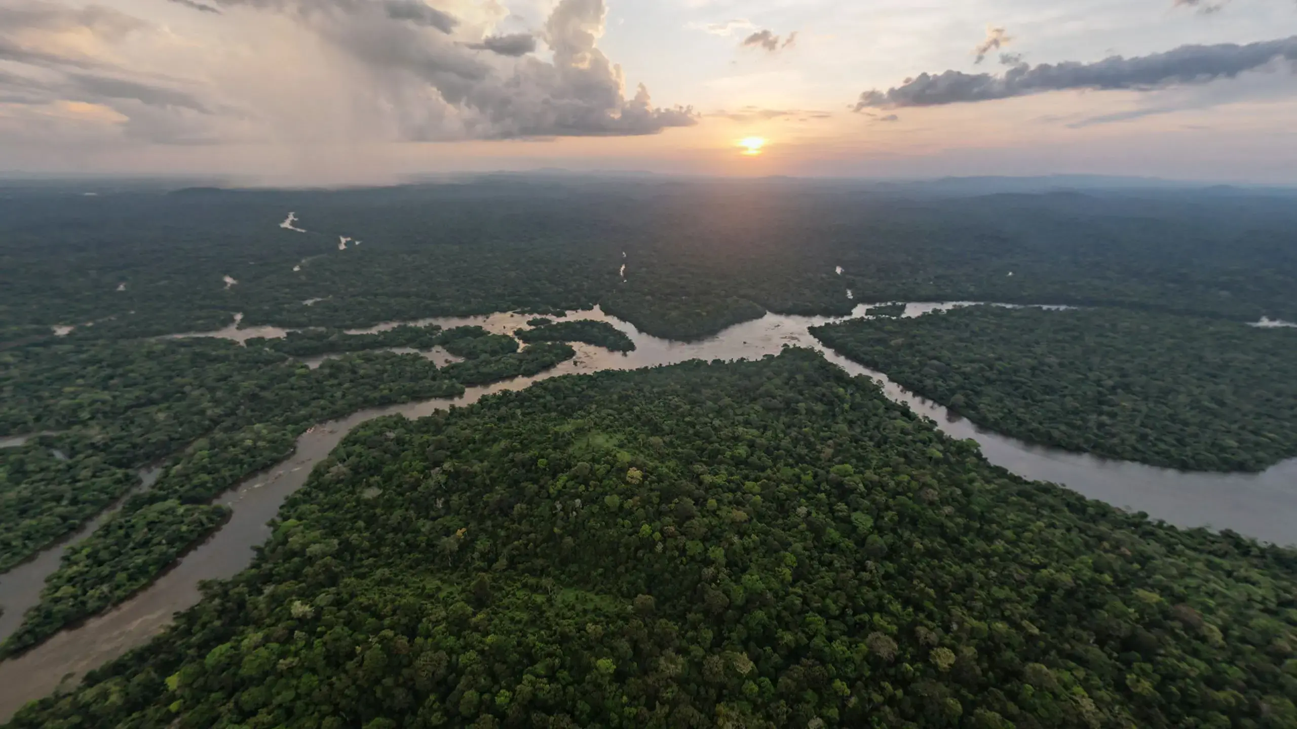
Gorgens and his crew of six had spent days trekking through dense, dangerous rainforest in a remote part of northeastern Brazil, some 250 kilometres from the nearest city. But during that expedition in September 2019, they eventually ran into steep terrain and spent several hours trying paths around and over it. Running low on food and fuel — and with no means of sending word to their base camp — the researchers reluctantly turned back. They were just 5 kilometres or so from the tree.
“I was so close. We were so close. Maybe one day more — maybe one morning more — we would get there,” says Gorgens, a forest engineer at the Federal University of the Valleys of Jequitinhonha and Mucuri in Diamantina, Brazil. They vowed to come back.
In September last year, Gorgens and a team of 19 others returned, armed with key lessons from their first attempt, better equipment and supplies for a longer mission. A Nature photographer accompanied them on their journey.
Their expedition sounds at times like a tale from science in the nineteenth century — hacking through unexplored jungle with machetes, dodging deadly animals, enduring torrential rains. But they also had help from twenty-first-century tools and data. A drone gave views from high above the forest canopy, and the team had exact GPS coordinates for the unknown tree.


The researchers are exploring basic questions about what controls tree height. And the data they collected could help to fill in details about how much carbon the Amazon holds, and whether threats such as climate change and deforestation will disrupt that capacity. But beyond those questions, the expedition serves as a reminder of the vast realms of unexplored wilderness and science, even in a world made small by mobile phones, the Internet and other modern technology.
“It’s incredible when you see how small we are at that fantastic site,” says Gorgens. “Not just the tree. All. The river, the challenges, the size of the forest.”
A second chance
During the 2019 expedition, Gorgens and his crew managed to visit a cluster of big trees, but their heart-wrenching failure to reach the tallest one left them eager to return. Then the COVID-19 pandemic hit, and it wasn’t until 2022 that the researchers could mount another attempt.
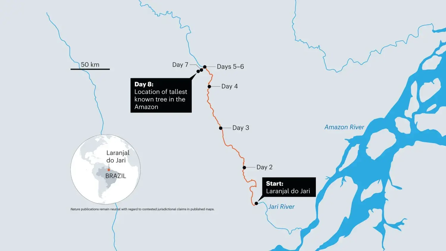
This time, they had a much better sense of what they would run into. The first leg would be a 260-km trip up the Jari River from the small community of Laranjal do Jari, near the mouth of the Amazon River (see ‘Amazon adventure’). That would take four days. Then the hard part would begin: a 20-kilometre slog through the same steep terrain and dense jungle that had forced them to turn back in 2019.
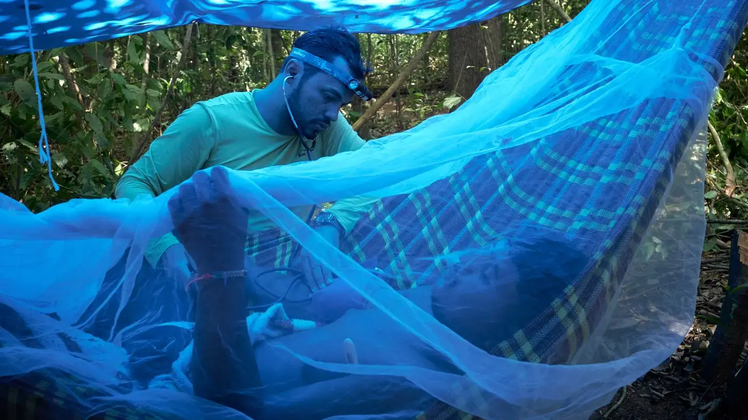
They began last year’s journey with 20 people, including 19 Brazilian scientists and crew members, and one UK researcher. But the problems started almost immediately. On the first night, one of the young team members from the local community came down with a fever and his leg started to swell. It seemed like symptoms of a spider bite, but he insisted he would be able to carry on. The same night, another crew member found out that his mother had died, so the next morning a boat ferried him several hours back to town and then returned. It cast a shadow over the expedition.
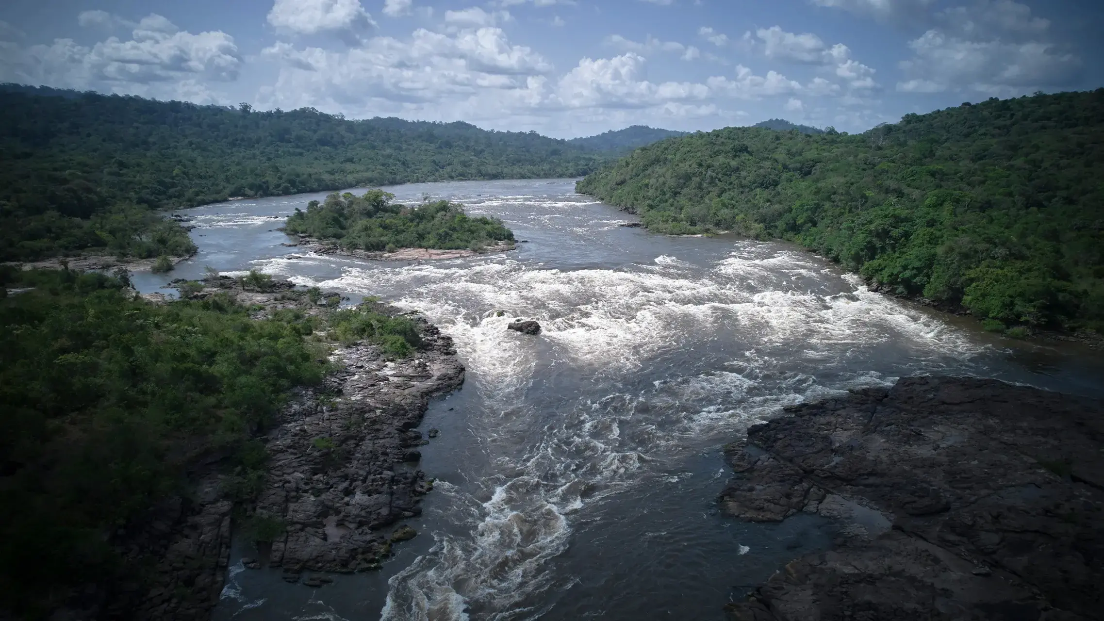
Several times over the next few days, the river was so low the crew had to get out of the boats and pull through rapids. For one section, everyone unloaded the boats and carried them.
Meanwhile, the man with the spider bite developed a high fever and signs of an infection. “He started to decline in the first two days quite dramatically,” says Gorgens. The crew nearly turned around to evacuate him before he responded to a new course of medication. Finally, after four days on the river, the team could start the second stage of its quest.
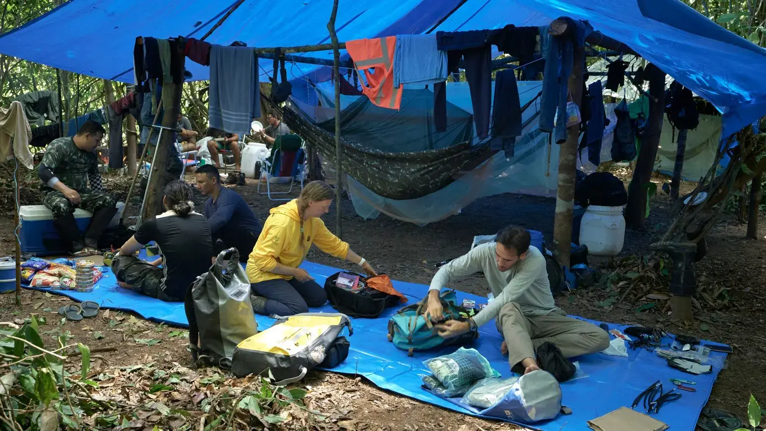
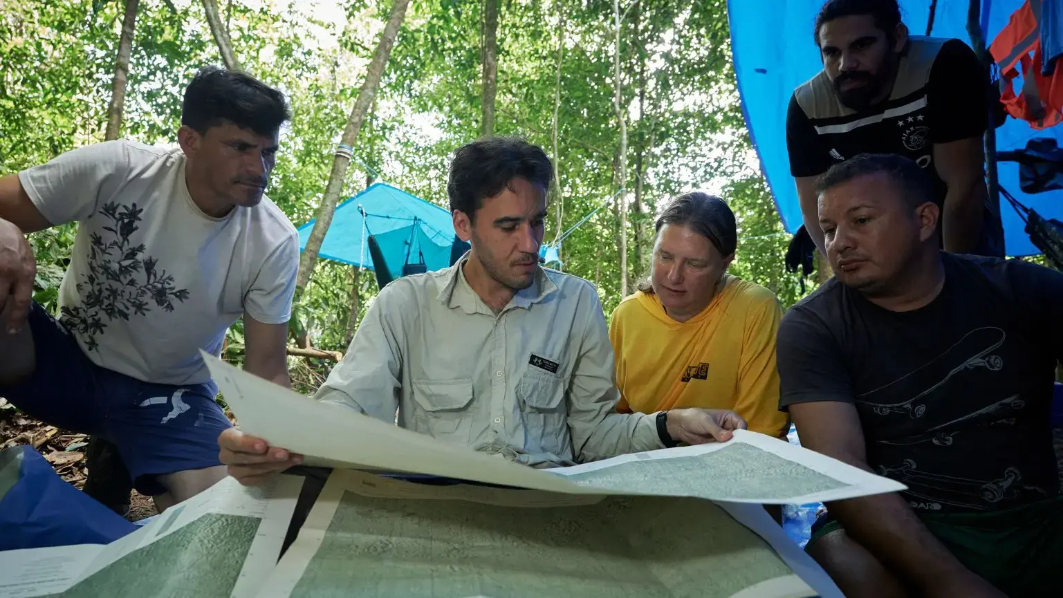
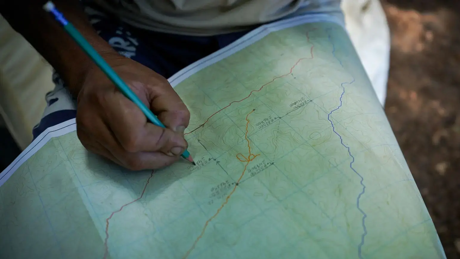
The researchers and support crew set up a base camp by the river, where three people remained, including the man with the spider bite. Gorgens and his team pored over maps and spent a day planning routes and organizing supplies. They set off for the tree around 6 a.m., hoping to get the most out of the daylight.
Captured by laser
At this point, Gorgens was in the odd position of knowing precise details about the tree – its height and position – without having seen it. It’s possible that no one had.
(No Indigenous people live within 100 kilometres of the tree, and even if they had passed by, it would have been impossible to see the top through the thick canopy.)
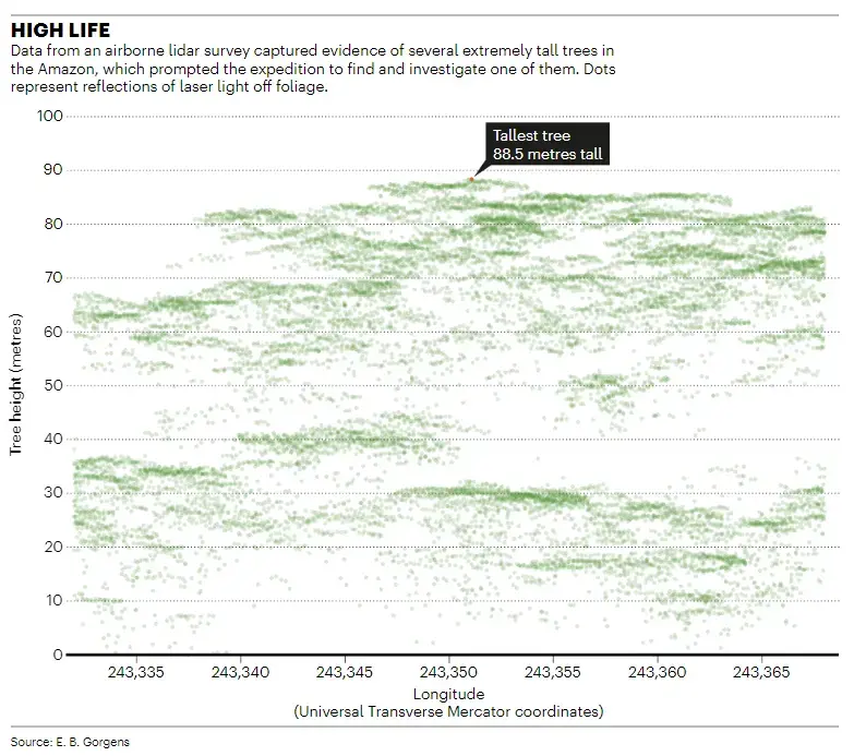
It was a chance discovery that brought Gorgens to this place. In 2018, he was studying height measurements of the forest collected by a Cessna aeroplane that had flown tracks over different parts of the Amazon between 2016 and 2018. The plane carried a lidar device that sends out laser pulses and measures the time it takes the reflections to return. Because the signals reflect off the ground and foliage, it provides a 3D portrait of the forest and extremely precise measurements of tree height.
But some of the data didn’t make any sense to Gorgens. The top of the forest in most lidar tracks reaches about 40 or 50 metres above the ground. But in some places, the data set included reflections from double that height. “In investigating these outliers, we saw they are really trees. That’s why we started this plan,” says Gorgens.
The record holder in the data set reached 88.5 metres from ground level to the topmost foliage visible in the lidar data. That’s nearly as tall as New York City’s Statue of Liberty (93 metres) or London’s Elizabeth Tower, popularly known as Big Ben (96 metres). This tree would be the tallest known in South America, although still far shy of the world record holder, a 116-metre-tall Sequoia sempervirens in Redwood National Park in California.
Gorgens and others reported their lidar discovery in 2019 (E. B. Gorgens et al. Front. Ecol. Environ. 17, 373–374; 2019). And there wasn’t just one giant. Near the tallest tree, the data showed several others reaching 80 metres or slightly higher. Across the Amazon, the lidar data revealed five other sites with unusually tall trees.
When the researchers published their findings, including a lidar-produced profile image of the tree, they captured attention across the globe — particularly in Brazil. One political party even used the ghostly image of the tree in some of its work. “It’s a symbol,” says Gorgens. “To connect people to the environment.”
For scientists, the lidar data helped to underscore how much remains unknown about the Amazon. “This discovery, from just a couple of years ago, highlights that we still don’t know everything,” says Jacqueline Rosette, a remote-sensing specialist at Swansea University, UK, who was part of last year’s expedition.
Constant scrutiny
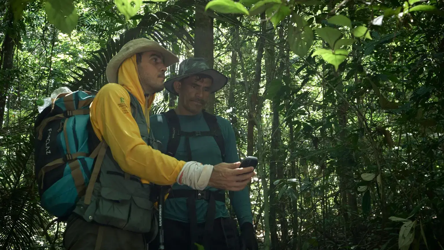
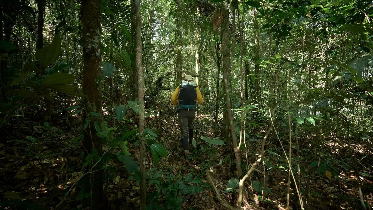
The first part of the trek was noticeably easier because Gorgens and his team were following the route they had cut through the forest three years earlier; it had only partially grown over. Then they took a wide route around the steep hill that had proved so troublesome during their previous attempt. With better maps, they were able to avoid a lot of steep terrain, says Gorgens.
Still, they had to lug heavy packs filled with food, tents and equipment in hot, humid conditions for 10–11 hours each day. They averaged about a kilometre per hour. “This is quite stressful because we don’t know what will come,” he says. They never knew whether they might hit some new obstacle, and were on constant watch for snakes — particularly pit vipers. A bite from one of the many venomous species in the area could prove deadly.
“Truthfully, it was the most challenging and physically arduous thing I’ve ever done,” says Rosette.
At around 4 p.m. on the second day of hiking, they reached their destination. And there it was, a massive tree trunk about 10 metres around, at exactly the right GPS coordinates.
Still, initially Gorgens wasn’t sure. “Thirty, forty metres away from this point, there were other big trees similar to this one,” he says.
To confirm the tree’s height, they would need a view from above the canopy. Although the team had brought climbing equipment during its 2019 expedition, they had decided it wasn’t worth the extra weight this time. Instead, they had a drone to do the work.
Bird’s-eye view


Once above the canopy, it was clear that the tree rises high above its neighbours. It belongs to the species Dinizia excelsa, also known as angelim vermelho, which are some of the tallest trees in South America. The other 80-metre-tall trees that Gorgens and his team have seen in the region are the same species.
From the vantage point of the drone, Gorgens could also see some of the surrounding topography. Close to the tree is a big hill. Rising some 200 meters higher than the tree top, it might be one of the reasons the giants thrive here, perhaps providing some protection from the wind. “I think this hill, close to the tree — I think it helps to promote the tree to grow,” says Gorgens.
That’s just one possibility. Beyond that, the region doesn’t get too much rain and has a lot of clouds, says Gorgens. “So we’re proposing that especially with [less] wind and indirect light, you create a very calm environment allowing trees to grow for long periods without disturbance.” They suspect the tree is at least 400 years old, but did not have permission to take a core sample to age it precisely.
The team collected leaves to deposit at a local herbarium, marked off a plot around the tree to catalogue the surrounding vegetation and collected soil samples from around the tree. Gorgens wants to do genetic analyses on these large Dinizia specimens to see whether they carry gene variants that differ from other Dinizia trees around the Amazon.
Rosette also used a handheld lidar device to scan the forest to obtain a high-resolution 3D structure of the vegetation surrounding the tree.
In the neighbourhood


One surprise, she says, was the lack of smaller Dinizia trees nearby that could replace the giant one after it dies. Another discovery came only later, after the team returned home. When the researchers calculated how much carbon was stored in and near the tree, they estimated that the giant trees hold about 60–70% of all the carbon in the surrounding hectare.
The big trees “are very much the big boss of that surrounding area,” says Rosette. “It was quite worrying actually to see you didn’t have the youngsters kind of coming through, ready to exploit when these older, mature trees succumb to natural mortality.”
Nevertheless, the fact that trees can grow so tall in this part of the tropics changes how researchers understand the region and its ability to store carbon that would otherwise contribute to global warming, she says. “This is a vital and a new discovery.”
The team camped at the tree’s base to continue measurements the next morning, but got little sleep because an intense storm swept through the area. Some people spent hours holding up their tents, and stinging ants invaded the camp during the night. At one point, a viper slithered through and had to be killed.
The next morning, they finished their measurements and packed for the two-day trek back to the boats. It was much easier going because they followed the same path back. And the boat trip downriver took one less day because they travelled with the current.
View a 360-degree view of the tree and the rainforest canopy on Nature.
Awaiting discovery
Gorgens knows he hasn’t seen the tallest tree in the Amazon. “I’m sure we will find bigger trees,” he says. The lidar surveys they did several years ago covered just 0.01% of the Amazon. So much of the basin remains unexplored, and he is hopeful that they can do more aerial surveys.
And the researchers now have access to another data set that offers clues for where to look for more tall trees. Between March 2019 and March this year, a lidar instrument called the Global Ecosystem Dynamics Investigation (GEDI) mission collected data from its position on the International Space Station. It has produced a map for the entire Amazon, but at much lower resolution than the data collected during plane-based surveys.
“We definitely see trees that are over 80 metres in the Amazon,” says Ralph Dubayah, principal investigator for GEDI and a remote-sensing scientist who studies ecology and climate at the University of Maryland in College Park. The lidar data collected from space even show some reflections over 90–95 metres in the Amazon, but Dubayah says these could be artefacts. Aerial lidar would be the gold standard, he says: “You can get highly accurate estimates of height — better than you can get in any other way.”
Dubayah adds that the remote monitoring has provided important information. “It’s been revolutionary in giving us insights into where these important stands of individual trees are and what we can do to protect them.”
The issue of protection for the Amazon is something the expedition members thought about as they made their long journey to and from the giant Dinizia. The tree is in a protected zone, as are many of the other large trees. “But it’s not completely remote,” says Gorgens. There is illegal mining close to some of the tall trees, he says. “We need to pay attention to these aggressions.”
During the tenure of Brazilian President Jair Bolsonaro from 2019 to 2022, deforestation rates spiked in the Amazon as the government supported agricultural expansion, while illegal mining and drug operations spread. Forest advocates hope that the administration of current President Luiz Inácio Lula da Silva will bring protections back and rein in the disturbances.


Last week, state-government representatives started discussing how to protect these tall trees, says Diego Armando Silva da Silva, a forest engineer at the Federal Institute of Amapá in Laranjal do Jari, who was the local leader for the expedition.
Da Silva says that when he stood before these giant Amazon trees, “I felt like I was in front of a monument of nature.” That’s a common reaction from the scientists on the team.
Beyond their height, Gorgens thinks about how long the trees have stood in the forest. “They were here when the Portuguese arrived. They were here when the Indigenous people had to leave their lands. They were here when climate change started to increase the disturbances,” he says. ”Our challenge is to try to understand what they say about us. To understand ourselves through the eyes of the giant trees.”
Mariana Lenharo contributed translations.
Author: Richard Monastersky
Original photography, video and drone footage: Pablo Albarenga for Nature
Media coordinator: Amelia Hennighausen
Photo editor: Tom Houghton
Art editor: Chris Ryan
Subeditor: Anne Haggart
Editor: Brendan Maher


