
Water users should plan for below normal water supplies in the coming months after one of the lowest statewide snow seasons on record, according to the recently released Natural Resource Conservation Service (NRCS) Montana Water Supply Outlook Report.
“Snowpack percentages are currently either the lowest they have been or near to it in many Montana river basins,” the report states.
As of May 1, snowpack percentages range from about 40-75% across Montana, with current conditions indicating a below normal runoff in most locations this summer. The only exceptions are rivers originating in the southern Absaroka and Wind River mountains, which are forecasted to have near to above normal runoff due to near normal precipitation this year.

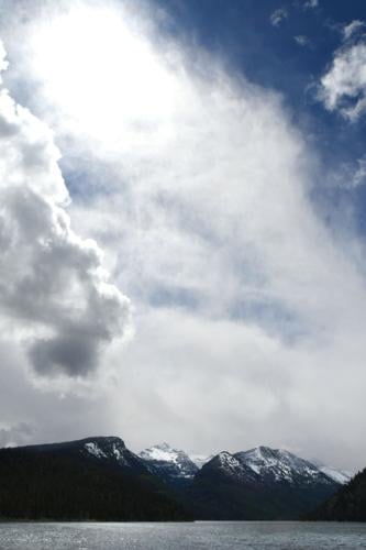
Snow falls on the mountains surrounding Lake Como south of Hamilton on Tuesday, April 30. Snowpack percentages are currently either the lowest they have been or near to it in many Montana river basins according to the recently released Natural Resource Conservation Service (NRCS) Montana Water Supply Outlook Report.
“Areas of greatest concern are the Shields, Teton, Jefferson, Beaverhead and Musselshell Rivers, which are forecasted to be 35-50% of normal for May-July,” said Eric Larson, USDA Natural Resources Conservation Service (NRCS) Water Supply specialist. “The 50% exceedance forecasts for the Smith, Missouri, Blackfoot, Big Hole, Clark Fork and Jefferson are 50-60% of normal.”
People are also reading…
For the Flathead, Clark Fork, Blackfoot, Sun, Missouri, and Yellowstone river basins, the entire range of exceedance streamflow forecasts falls below the median May-July volume for most streams. Meaning that even with well above normal precipitation during May, below normal runoff volume is expected this season. A cool and wet spring could help supplement runoff this summer, the report states, but overall runoff will likely be below normal.
“If weather remains active and precipitation is well above normal in the coming weeks, then runoff could be greater than the 30% exceedance forecasts,” the report states. “Keep in mind that the 30% exceedance forecasts for May 1 are still only about 65-75% of normal on the Rocky Mountain Front, part of the Flathead, the entire Clark Fork, Blackfoot, and Bitterroot river basins.”
Well above normal precipitation was needed in April to make up for this year’s below-average snowpack conditions, however, April did not deliver the snow and precipitation needed to achieve snowpack recovery. April precipitation was overall about 65-80% of normal with a couple of isolated locations that were higher; the Gallatin and Bitterroot basins received about 90-95% of normal precipitation in April.

Montana Snow Survey hydrologist Florence Miller measures the meager remaining snowpack in the rain at Four Mile snow course during the May 1 survey. April did not deliver the snow and precipitation that were needed for snowpack recovery. During the May 1 survey, 32 of the 98 snow courses measured were completely snow-free.
April temperatures in Montana were above normal by 1-3 degrees F across the state. The above normal temperatures and a lack of sufficient precipitation during April led to decreases in the water supply forecasts for many locations. Several SNOTELs and snow courses have already, or are close to melting out, which is up to two weeks early in some cases. Thirty-two of the 98 snow courses measured were completely snow-free during the May 1 survey.
May 1 snowpack percentages range from about 55-75% of normal across most of Montana. Powder and Tongue River were the only basins to improve upon their snowpack in April. Peak date for median snowpack in most basins occurs in mid-April. The Upper Missouri and Sun-Teton-Marias are lower at about 40%. The Bighorn and Tongue River basin snowpack is closer to normal at about 80-85%. The Upper Missouri, Bitterroot and Sun-Teton-Marias River basins saw the largest snowpack percentage decreases over the last 30 days due to significant snowmelt at all elevations over the last month.
If the weather stays cool and additional snowpack accumulation occurs, basin-wide snowpack percentages will likely increase, but Larson warned that even “if a percentage in a basin that had a low snowpack all year nears 100% in May, that doesn’t mean a full recovery has been achieved.”
The current U.S. Drought Monitor map, released on Thursday, May 2, classifies 43% of Montana as moderate to extreme drought. The monthly temperature and precipitation outlooks for Montana indicate equal chances for above or below normal temperatures and precipitation. Lower temperatures and higher precipitation could help maintain snowpack, while higher temperatures and lower precipitation could drive further melting.
In the Bitterroot

A boater prepares to launch his boat at Lake Como on Tuesday, April 30. Water users should plan for below normal water supplies in the coming months after one of the lowest statewide snow seasons on record according to the recently released Natural Resource Conservation Service (NRCS) Montana Water Supply Outlook Report.
Every year is a balancing act for water managers in the Bitterroot Valley as they measure the needs of irrigators, fish and other water users. JR Iman, dam tender at Painted Rocks Reservoir said it’s up to Mother Nature at this point.
“It's gonna be tight,” he said. “A lot of this rain that's happening right now, we're getting lakes full, but we're gonna need help this summer from somebody.”
Painted Rocks will be full by May 8-10, which is about what Iman is looking for. But much of what happens in the coming months will depend on the weather.
“Mother Nature usually takes care of the Bitterroot, but not necessarily when we want it.”
In a normal year, the highest water of the year is in the second week of June, Iman said. Last year, and about four or five years ago, the highest water of the entire year was on around May 15.
“In the Bitterroot Valley, all of the water that the irrigators get out of Painted Rocks and all the fish get out of Painted Rocks, basically lasts about 40 days,” he said. The Painted Rocks water users — that’s the irrigation part — and Fish and Game — that's FWP — purchase from the State of Montana the right to use 25,000-acre-feet of water, and that lasts about 40 days. So we get what we get and the question is, how long. It’s not whether you get it, it's how long you're gonna get it, and when your season ends. So, every little bit helps.”
Iman warned that water is a finite resource, and you’ve got to be really careful with what Mother Nature gives you.
“Everybody starts running out about the same time, the last two weeks in July and the first week in August,” he said. “And then you only got so much. If you give away too much at first you got nothing left, but if you don't use it while it's available, there's so little left that it won't go around… if you try to hold it clear till the end, you lose it when you could use it and there's not enough left.”
Iman said that before 1985, the Bitterroot used to dry up every year at Bell Crossing, but now with the way the water contracts are written, in a good year they try to keep 600 cubic feet per second at Bell Crossing.
“We make that in all honesty about four years out of 10,” he said.
One a cubic foot per second is about a gallon and a half of water. Last year, they had 230 CFS, Iman said.
“The way the contract is written, you know, nobody starves, but everybody gets hurt a little bit.”
Iman said that people are going to have to be careful with their water use in the coming months.
“You have to be really cognizant of what's going on, and you got to work with what Mother Nature gives you."


